05/03/2024
 The administrative map plays an extremely important role for any country. It serves as a tool to determine the territory of a nation. Based on the administrative map, the state can formulate policies and measures to manage and protect the sovereignty of the country’s territory.
Moreover, it is utilized by various levels and sectors for administration, economic development, and social progress. So, what is an administrative map? What benefits will digitizing the national administrative map bring? Let’s explore this in detail in this article with Goong.
Overview of administrative maps
Overview concept
Based on the regulations in Clause 1, Article 3 of Circular 47/2014/TT-BTNMT detailing the technical requirements for establishing administrative maps at all levels issued by the Minister of Natural Resources and Environment, the matter is specified as follows:
An administrative map is a specialized map that represents the territorial division and administrative unit management as prescribed by the State of Vietnam.
Classify
According to the regulations in Article 4 of Circular 47/2014/TT-BTNMT, the administrative maps at all levels include six types as follows:
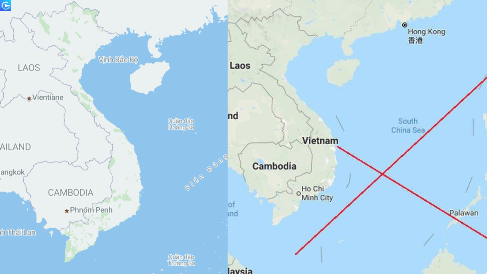
National administrative map: This map represents the division and management of provinces within the territory of Vietnam, including mainland, seas, islands, and archipelagos.
Provincial administrative map, centrally-run cities: This map illustrates the division and administrative management of districts and communes within the territory of a province or centrally-run city.
District, ward, town, city under provincial administrative map: This map displays the division and management of communes under the territory of a district, ward, town, or city within a province.
National administrative map collection: This collection comprises administrative maps of provinces within the territory of Vietnam of equal size.
Provincial administrative map collection: This collection includes district-level maps within a province of equal size.
District-level administrative map collection: This collection comprises commune, ward, and township maps within a district of equal size.
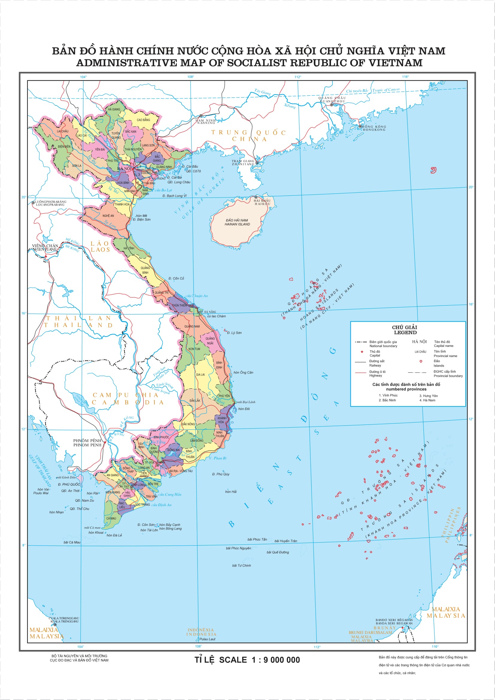
Administrative map of Vietnam
This map is known as the Vietnam map, providing detailed information about the geography, transportation, and other aspects of provinces and cities.

Administrative map of 63 provinces and cities in Vietnam
Vietnam is divided into three regions: Northern, Central, and Southern, corresponding to seven different economic regions.

Northern Vietnam (Bac Bo)
Northeastern region:
Northeastern region: Ha Giang, Bac Can, Cao Bang, Tuyen Quang, Lang Son, Thai Nguyen, Bac Giang, Phu Tho, Quang Ninh.
Northwestern region: Lao Cai, Dien Bien, Yen Bai, Lai Chau, Hoa Binh, Son La.
Red River Delta: Hanoi, Bac Ninh, Hai Duong, Ha Nam, Hai Phong, Nam Dinh, Hung Yen, Thai Binh, Ninh Binh, Vinh Phuc.
Central Region:
Northern Central: Nghe An, Thanh Hoa, Ha Tinh, Quang Tri, Quang Binh, and Thua Thien – Hue.
The coastal South Central region: Khanh Hoa, Binh Thuan, Ninh Thuan, Quang Nam, Quang Ngai, Da Nang, Binh Dinh, and Phu Yen.
The Central Highlands: Kon Tum, Gia Lai, Dak Nong, Dak Lak, and Lam Dong.
The Southern Vietnam (Southern Region)
The Southeast Region: Binh Duong, Binh Phuoc, Tay Ninh, Dong Nai, Ba Ria – Vung Tau, and Ho Chi Minh City.
The Southwest Region: Long An, Dong Thap, An Giang, Tien Giang, Ben Tre, Tra Vinh, Vinh Long, Kien Giang, Hau Giang, Bac Lieu, Soc Trang, Cau Mau, and Can Tho City.
The benefits of digitizing the national administrative map
- Enhanced administrative management: helping to improve geographical information management, thus supporting urban and rural planning, investment, development, and natural resource allocation.
- Easy information access: users can easily access necessary administrative information through digital devices such as mobile phones and computers, saving time and increasing efficiency.
- Support urban planning and development initiatives: providing urban managers and planners with accurate information on topography, transportation systems, land planning, and other climate factors, thus aiding in the urban planning and development process.
- Enhanced disaster forecasting and response: providing accurate geographical and environmental databases to improve the ability to forecast and respond to natural disasters such as floods, landslides, and climate change.
- Promotion of economic development: creating favorable conditions for local and national economic investment and development through clear understanding of resources and infrastructure.
- Enhanced quality of public services: government departments make proposals and implement social security policies based on regularly updated data, enhancing the quality of public services and increasing citizen satisfaction, thereby improving their quality of life.
Given their crucial roles, maps are an indispensable tool for a country in safeguarding sovereignty and managing its territory. In the current digital transformation trend across all sectors, digitizing administrative map data in the digital space is extremely important. In the digital transformation journey, Goong cannot afford to be left out of the race